Significance
Lithuania became an independent country in 1918, and in 1919 its’ second-largest city Kaunas was declared the temporary capital (the historical capital Vilnius was annexed by Poland in 1920). Kaunas functioned as the capital city for twenty years, until 1939. The city plan of 1923 had included suburban areas and the lands of the former stronghold within the territory of the city, and the new residential areas were to be built following the principles of garden cities. The direction that the urban development of new Kaunas would take was heavily influenced by the landscape: the old, historical core of the city, together with the New Town, were located on the very banks of the rivers, whereas the new Kaunas ended up expanding across the terraces on hillsides and slopes by river valleys. From 1918 to 1940 there were more than 12,000 construction permits granted across Kaunas; for a city of a relatively small size (90,000 residents), this was a particularly rapid growth that had completely changed its’ character. With that said, the very image of new Kaunas was determined not by the new, monotonous residential or industrial areas being built, but rather by the interweave of functions, as well as stylistic variety and urban nature. The new modernist buildings in Kaunas were to maintain a close relation to the existing historical background and natural frame of the city. Such a unique combination of functional and visual connections forms the very value of the city, and helps Kaunas stand out as a modern city that is also very much in touch with its’ historical and natural environment.
The territory provided in the Tentative List to be considered for nomination includes the areas of New Town and Žaliakalnis. From 1919 to 1939 the mentioned areas had witnessed a rise in new public buildings, as well as a wide variety of residential buildings. The transformation of these areas reflects the unique changes of Kaunas City. It is these locations that best reveal the synergy between the existing city as it was at the time, and the need for a new urban environment and city infrastructure that would allow the capital to meet all the requirements for a modern city. The architectural character of the New Town is being formed by the rapid development of a new architectural layer that has absorbed the old heritage and transformed the territory into an urban landscape commonly seen during the first half of the 20th century. Žaliakalnis is a town of settlers. It was formed following the garden city-planning principles, with respect to the natural frame of the area and its’ urban heritage as a military stronghold. This reveals the optimistic mentality of an emerging modern country, and the ambitious, intangible aspirations placed on the construction of the new capital – expectations that were interwoven with the traditions present in the region and the city itself. This change has taken a physical form and can be witnessed in urban, architectural, and immaterial dimensions.

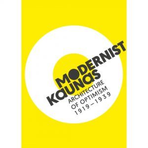
Author of visual identity L. Gliaudelis, 2020.
It is important to note that the Tentative List and its’ preparation are only a part of the whole process that would ensure its’ success. What is also of great importance is the education of the city community, the support from Lithuanian heritage institutions and professionals, as well as the visibility of Kaunas on an international level. In order to achieve these goals, it is crucial to continue organising events dedicated to different audiences throughout the whole process of the preparation of the application. The implementation of the Kaunas 2022 European Capital of Culture project has worked in favour of the objective, since one of its’ programmes, “Modernism for the Future”, is aimed towards the presentation of modernist architecture and the education of heritage community. Cooperative efforts of the Ministry of Culture of the Republic of Lithuania, Kaunas City Municipality and its’ Department of Cultural Heritage, Kaunas 2022, Lithuanian National Commission for UNESCO, KTU Institute of Architecture and Construction, as well as other organisations and professionals have resulted in several events: an international travelling exhibition “Architecture of Optimism: Phenomenon of Kaunas, 1918–1940”, two international Summer Schools, an international conference, and forums. Various organisations and initiatives focusing on presenting architectural heritage, such as “Ekskursas”, “Gražinkime Kauną” (Beautify Kaunas), have emerged, as well as numerous artistic interpretations of modernism.
Process
In 2015, the Kaunas architectural heritage of 1919–1940 was awarded with the European Heritage Label. The Label is a sign of proof that the temporary capital had played an important part in the creation of modern Europe. In the same year Kaunas was recognised as a UNESCO City of Design, joining 47 other cities with such designation. By becoming a member of the UNESCO Creative Cities of Design Network, Kaunas undertakes to develop international cooperation, seek sustainable development, strengthen its’ participation in the cultural life, and ensure the integration of culture in city development plans.
In 2017, the Tentative List detailing Kaunas modernist architecture “Kaunas 1919-1939: The Capital Inspired by the Modern Movement” was included among the Tentative Lists of States Parties for UNESCO World Heritage Convention. This is an important step towards having the territory inscribed on the UNESCO World Heritage List, since nominations will not be considered unless the property is included in the State Party’s Tentative List. The inclusion of a property in the State Party’s Tentative List represents the State’s intent to submit the nomination file for the property to be included on the World Heritage List.
Submission of nomination files and the process of final evaluation are preceded by the long process of nomination that takes no less than two years. In order to begin this process, the State has to prepare a nomination file. This file has to meet the selection criteria, provide plans detailing protection and management instruments, and be exhaustive in justification for inscription on the World Heritage List. Nomination file is to be submitted on behalf of the State Party (signed by the delegated official on behalf of the State Party). The nomination is submitted to the World Heritage Centre for review and to check if it is complete. Upon approval, the file is sent to be evaluated by the Advisory Bodies: the International Union for Conservation of Nature (IUCN), and the International Council on Monuments and Sites (ICOMOS), which respectively provide the World Heritage Committee with evaluations of the cultural and natural sites nominated. The Committee then makes the final decision on the inscription of the property.
The first stage of the preparation of the nomination file includes several crucial segments: preparation of the Statement of Outstanding Universal Value, including its’ justification and presentation of the historical overview. The first and most important part of the whole process is the Statement of Outstanding Universal Value. Historical overview justifying the Outstanding Universal Value shall be prepared in the form of a comparative analysis in relation to the many properties previously nominated for the UNESCO World Heritage List. The nominations that are geared towards preserving the urban dimension of the modernist period are of particular relevance. These are the examples of nominations most similar to Kaunas in every parameter: Ivrea (Italy), Asmara (Eritrea), Pampulha (Brazil). Other nominations that have an urban dimension are Berlin and Tel Aviv. The historical overview consists of two types of text: a coherent text detailing property’s history, and individual object descriptions. The aim of the former is to detail the urban and stylistic features, as well functional types of the property. The architectural information is expanded upon through descriptions of each object. The Statement of Outstanding Universal Value also includes an overview describing the political and cultural development of Kaunas City.
Presentation of the activities of the work group to the public, 2019.
The third stage is concerned with the Justification of the Value. It is an initial proposal for nomination, on the basis of which, and with consulting from local and international experts and communities, the final Statement of Outstanding Universal Value is to be prepared in 2019–2020. This stage details the territorial boundaries of the property nominated and provides the Justification of the Value. The text includes The Outstanding Universal Value and its’ authenticity and/or integrity, information supporting the relevant criteria, as well as the comparative analysis. The points and arguments provided in this stage shall be discussed in 2019 with international experts, as well as local heritage and architecture specialists.
The last part of the application text provides the analysis of the property protection status and potential threats, as well as the plan detailing the implementation of property management and monitoring programmes. This was the preparatory stage; the first one to be completed for the application in 2018. The aim of this stage was to analyse the dossiers written for earlier nominations, and to prepare the main methodological guidelines, based on which the final versions of the stages shall be done in 2019 and 2020.
Application Submission Process Calendar for 2020–2022:
September 30, 2020 – the draft of the Nomination File is submitted to World Heritage Centre for review.
November 15, 2020 – World Heritage Centre provides feedback on the completeness of the Nomination File.
February 1, 2021 – final version of the Nomination File is submitted to World Heritage Centre.
February 1 – March 1, 2021 – World Heritage Centre registers and evaluates the Nomination File for completeness in terms of required documents submitted. In cases of the File being incomplete, the State is informed of the decision to postpone the nomination procedure until the next year. If the File is suitable and completed, it is sent to ICOMOS for evaluation, and information about the nominated property is published on the web site of World Heritage Committee.
March 1, 2021 – May 1, 2022 – ICOMOS evaluates the Nomination File and attached documents (Property Management Plan, Statement of Outstanding Universal Value, and others).
January 31, 2022 – World Heritage Committee discloses the interim evaluation of the Nomination File, formed in accordance with the feedback from ICOMOS, to the State and the World Heritage Centre.
February 28, 2022 – State reviews the evaluation received, and provides the necessary additional information, answers, and explanations.
In 2022, with no less than 6 weeks left until the ordinary session of the World Heritage Committee, ICOMOS provides the final evaluation of the Nomination File to the Committee and the State, together with the recommendation to inscribe the property on the World Heritage List if all criteria are met.
The period for the very last errors to be corrected is 2022, 14 business days before the ordinary session of the World Heritage Committee.
June/July 2022 – World Heritage Committee makes the final decision regarding the property’s inscription on the World Heritage List during the ordinary session.
What makes the case of Kaunas special?
Multilayeredness
Various historical layers – from the Late Medieval Period, to the end of the 20th century – and the distinct forms of their symbiosis can be identified within the nominated territory. The urban character of the territory carries all the elements crucial for the reflection of cultural integrity of the property, architectural and social specificity of the newly created capital, and the unique material and immaterial heritage. Visual relations, panoramas, open spaces, topography, and elements of the urban grid (large modernist living quarters from the 19th century, the garden city plan of 1923, and certain elements of the Soviet Period that further reflect the personality of the Interwar architecture) are of highest level of authenticity in the city, and are protected by national law. The entire city has more than 6000 buildings that were built during the Interwar period and remained until this day. The majority of these buildings are located in the New Town and Žaliakalnis. These areas are particular in that different typologies coexist there together, as well as all the different administrative, public, industrial and residential buildings, and forms of transport (funiculars of Aleksotas and Žaliakalnis that are currently still operating). All of the latter are of excellent representative value. The uniqueness of the place is reflected not only through the facades of the buildings, but also through preserved original elements of design and environment.
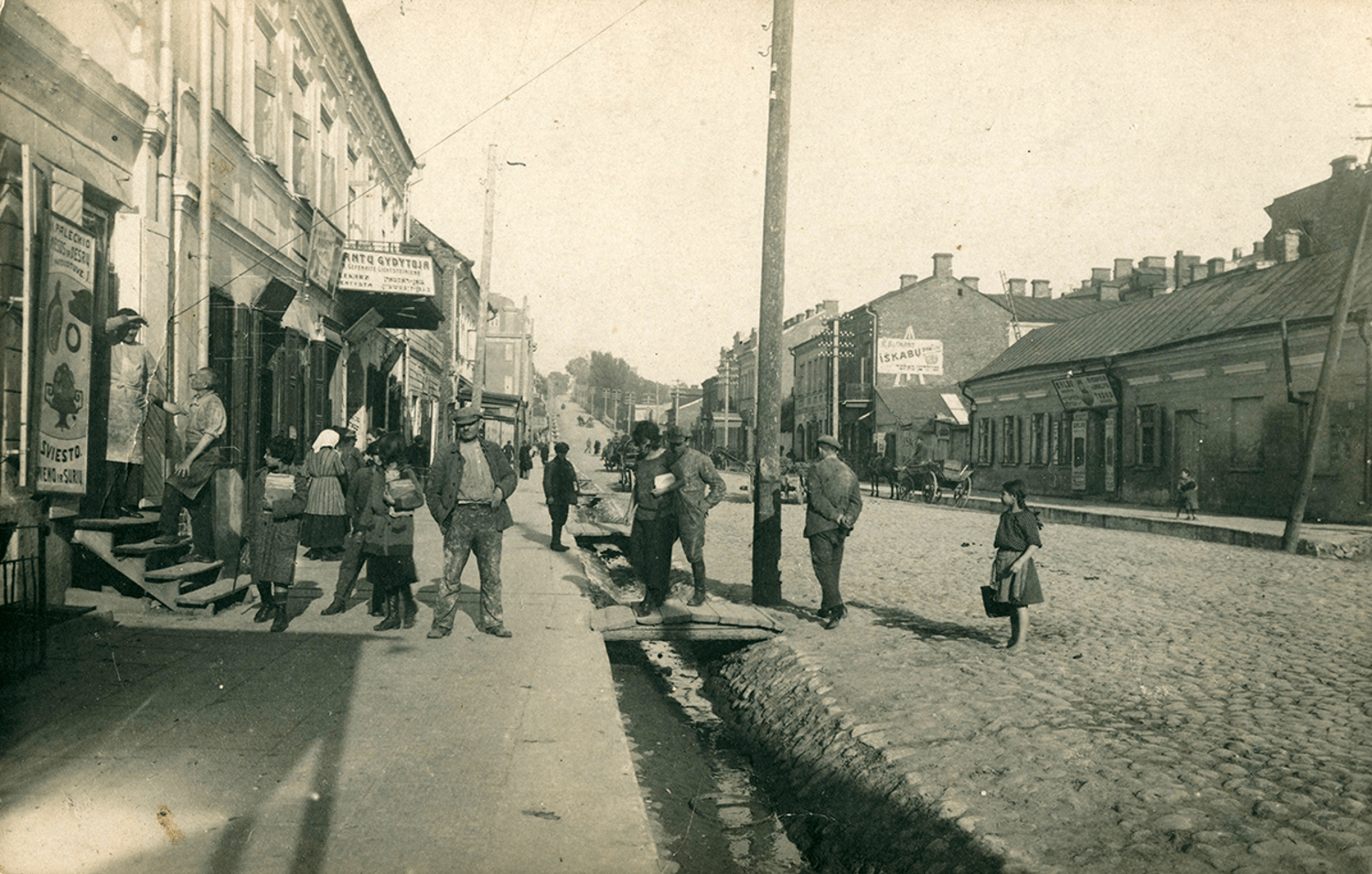
Savanorių Avenue, Kaunas, beginning of the 20th century. Photo source: private collection of A. Burkus.
Integrity
From 1918 to 1940, the New Town became the new administrative and social core of the country, exemplifying the key architectural features of modernism. The nomination of the New Town for the World Heritage List is based on the fact that the biggest number of the most significant modernist buildings that have maintained their authentic architecture is there. The restoration of the space in the centre of Kaunas City that provides the opportunity to remember our statehood is of great importance if we seek to preserve the immaterial value. Žaliakalnis, with its’ partially implemented garden city structure and proposals for new residential areas that were first mentioned in the 1923 Kaunas urban development plan, is an example of a modern city undergoing urban development. During the Soviet Period, the integrity of the area became more defined through embraced traditions and aesthetics of the Interwar modernist architecture. The buffer zone consists of many other less authentic, integral or important interwar-period buildings and groups of buildings, which help to maintain the character of the city.
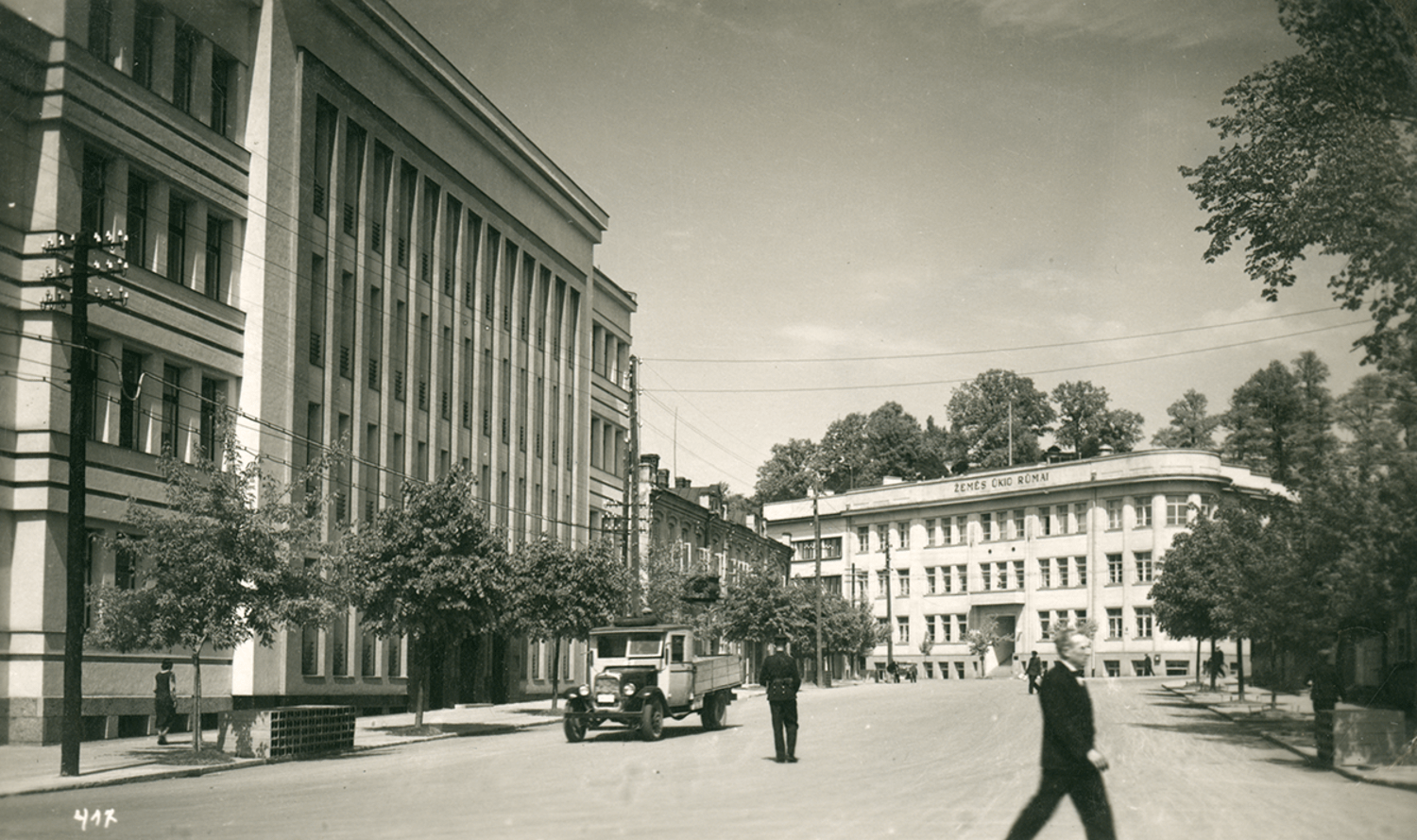
Vytautas Avenue, Kaunas, 1930s. Photo source: Central State Archives of Lithuania.
Territories
The nominated property consists of particular areas of the historical Kaunas City that represent the local modernist urban environment: The New Town (Historical Area of Kaunas City referred to as The New Town, unique code 22149), Žaliakalnis (Historical Area of Kaunas City referred to as Žaliakalnis, unique code 22148; Historical Area of Kaunas City referred to as Kauno Žaliakalnio 1-oji, unique code 31280), as well as the Ąžuolynas Park (unique code 17381), located between and connecting the areas of the New Town and Žaliakalnis. The last property included – the Complex of Armaments Board Research Laboratory buildings (unique code 28567); this area is legally protected in accordance with heritage protection regulations.
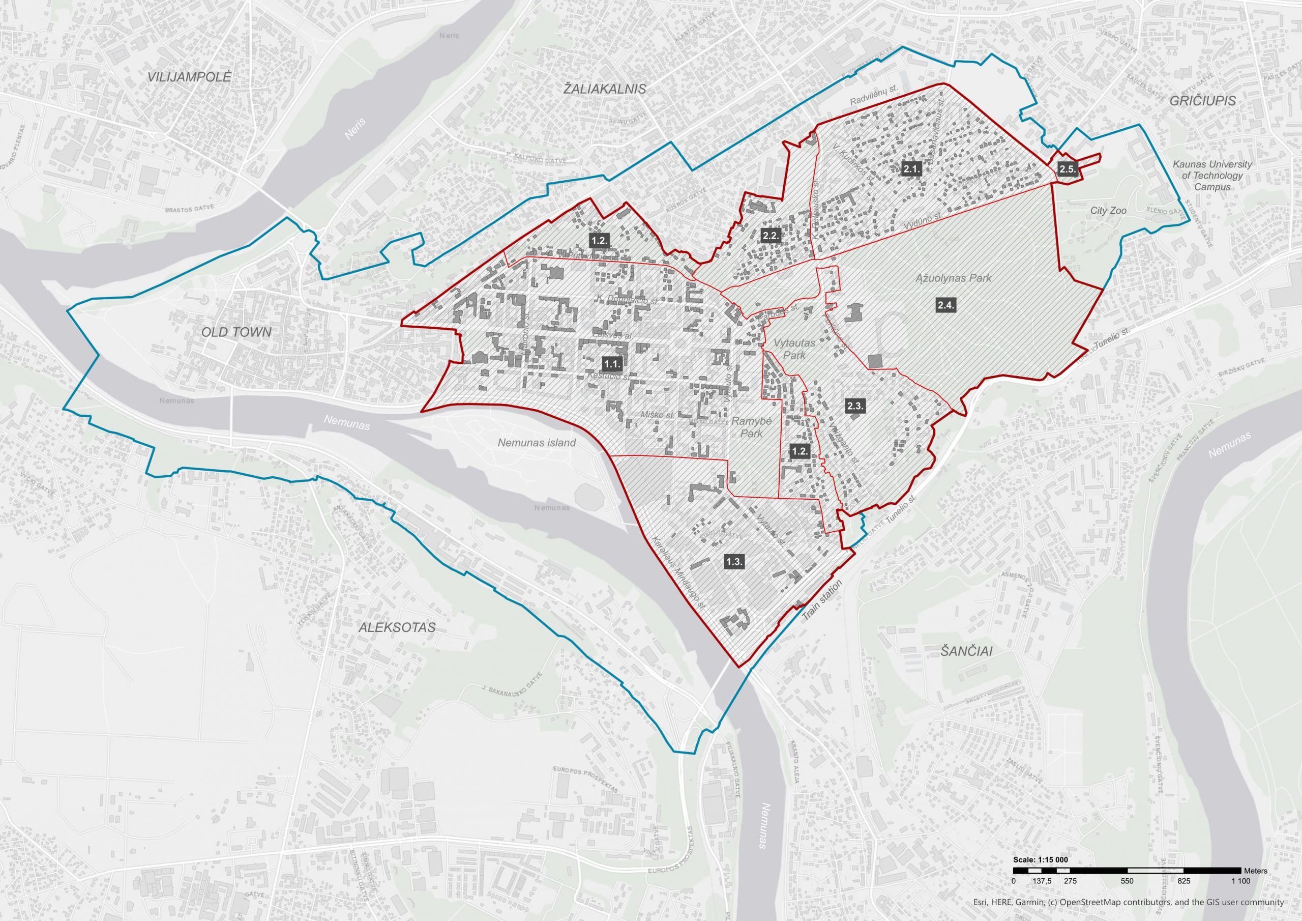 Map of the nominated property. Legend: red line – nominated property, blue line – buffer zone, grey structures – buildings in the nominated property constructed in 1919–1939. Zones: 1.1. The Representative New Town, 1.2. The Residential Area of the New Town, 1.3. The Industrial Area of the New Town, 2.1. The Garden City, 2.2. The Kaukas District, 2.3. The Perkūnas District, 2.4. Ąžuolynas Park and the Sports Complex, 2.5. Research Laboratory Complex.
The New Town
The Representative New Town
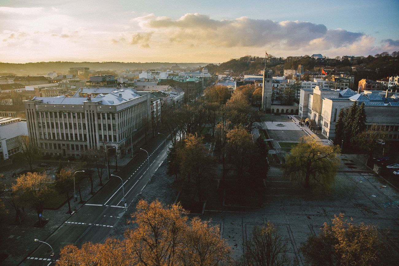
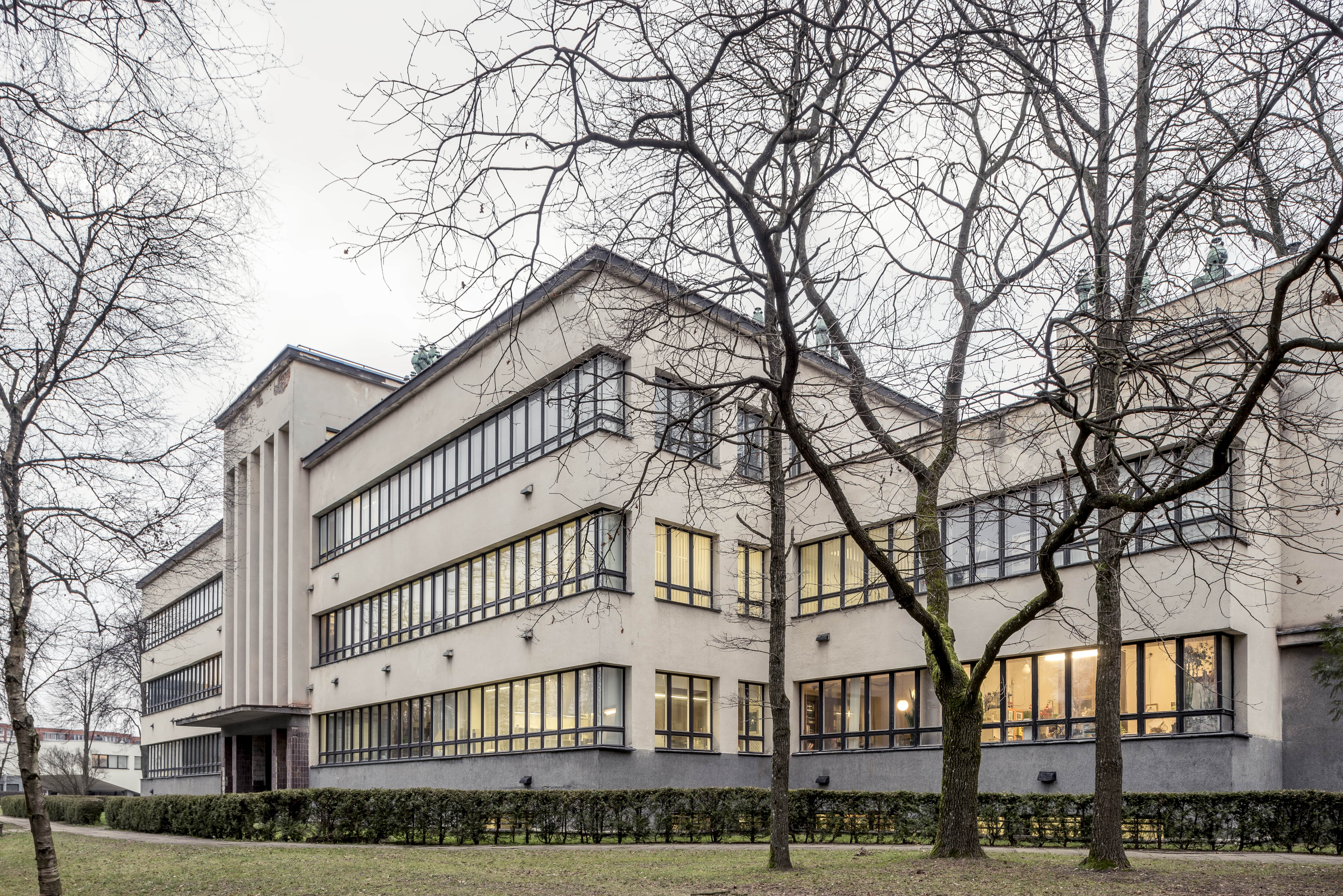
The Historical Area of Kaunas City referred to as the New Town covers 226 ha of land. The New Town is rectangular in street positioning, with some streets being positioned parallel to the river Nemunas, while others are perpendicular, connecting the riverside to the hillside. The parallel positioning can be attributed to certain key functions of the areas where such streets are prominent. During the Interwar period, the river embankment was an active industrial area, with various factories operating there. What is more, there was a port, which resulted in the embankment also being busy in terms of transport. The parallel K. Donelaičio St. and Kęstučio St. were positioned in the very core of the dynamic city centre that was starting to form around Laisvės Avenue, with the V.Putvinskio St. along the hillside becoming a symbolic boundary between the active city centre and the quiet, peaceful Žaliakalnis. The new, modern buildings of the New Town had formed a compact multifunctional core of the city that served all the needs of its’ residents: there were residential areas, commercial, educational, industrial, medical facilities. There were also zones designed for entertainment and recreation, even though spaces for recreation were more prominent in Žaliakalnis and other areas further away from the city centre. The New Town showcases very well the rapid transformation of Kaunas through its’ development from the sparsely built, low-rise part of the city to a modern city centre.
The New Town of Kaunas. Photograph: M. Plepys (2016).
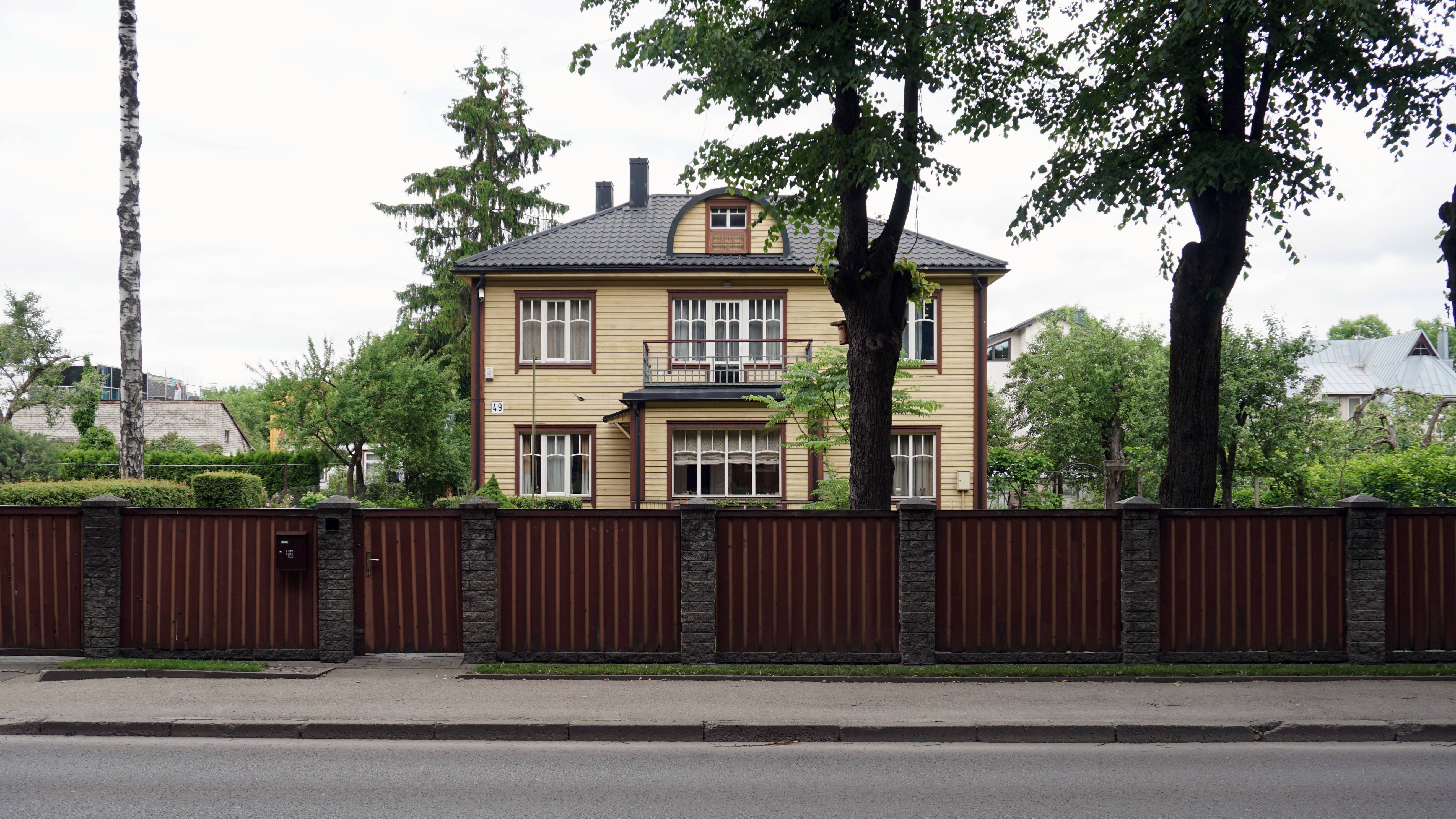
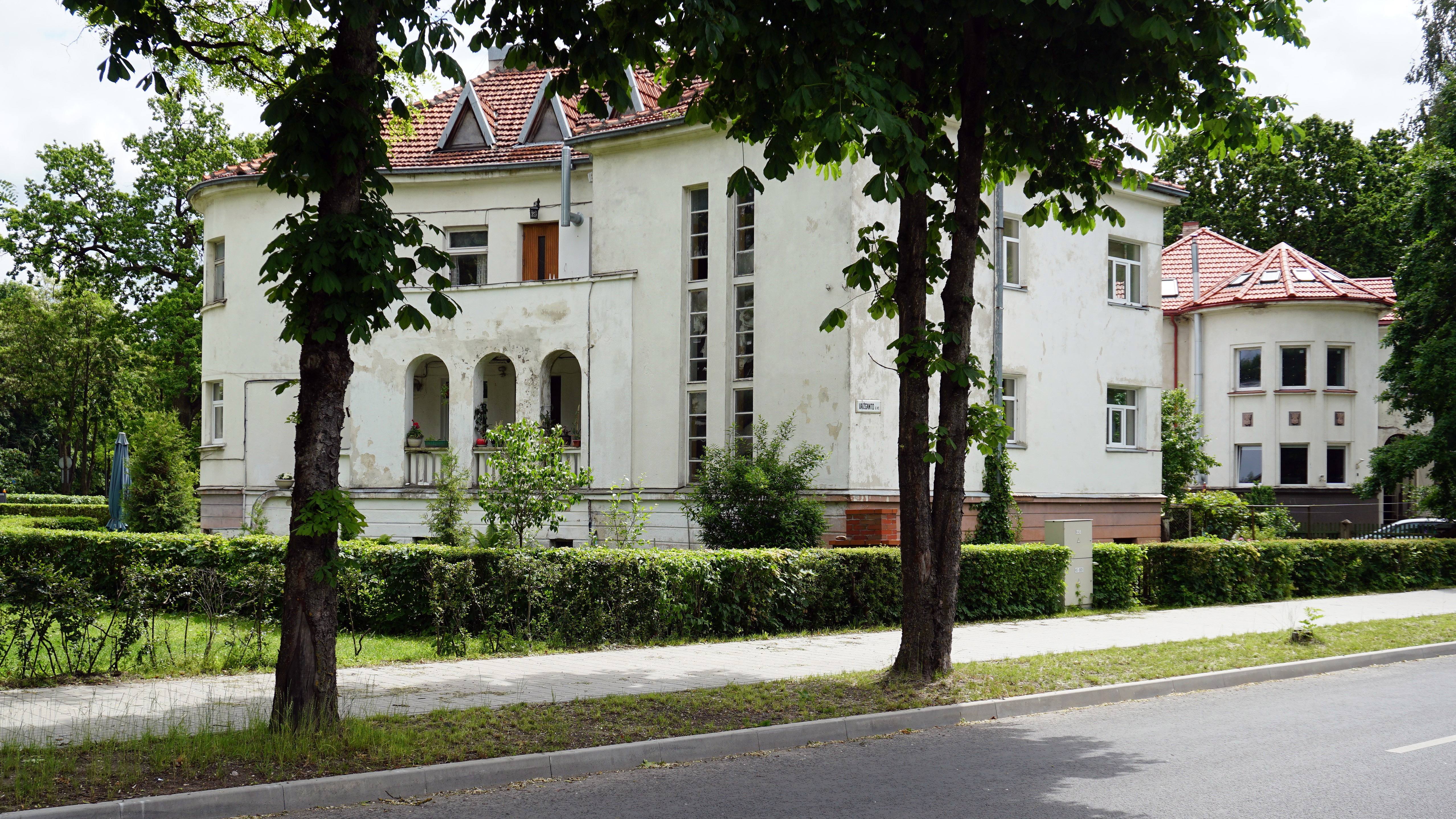
The Residential Area of the New Town
Representational villas and blocks of flats at the edge of the New Town are the result of an important phenomenon, integral to the character of the city: hillside urbanisation. The most intense period of construction in that area was from 1923 to 1939, whereas during the Soviet Period there were much fewer construction projects being carried out; the same tendency of much more passive construction works can be observed throughout the last few decades as well. On the whole, this does not leave any substantial effect on the authentic urban look and feeling created during the Interwar Period. Despite the hillside stretching across the entire western edge of the New Town, historical events have led to there being two zones of representational residential buildings: the area from the city centre to the Christ’s Resurrection Church (from V. Putvinskio St. to Aušros St.) and the area from the Serenity Park to Vaižganto St. (from Trakų St. to K. Būgos St.).
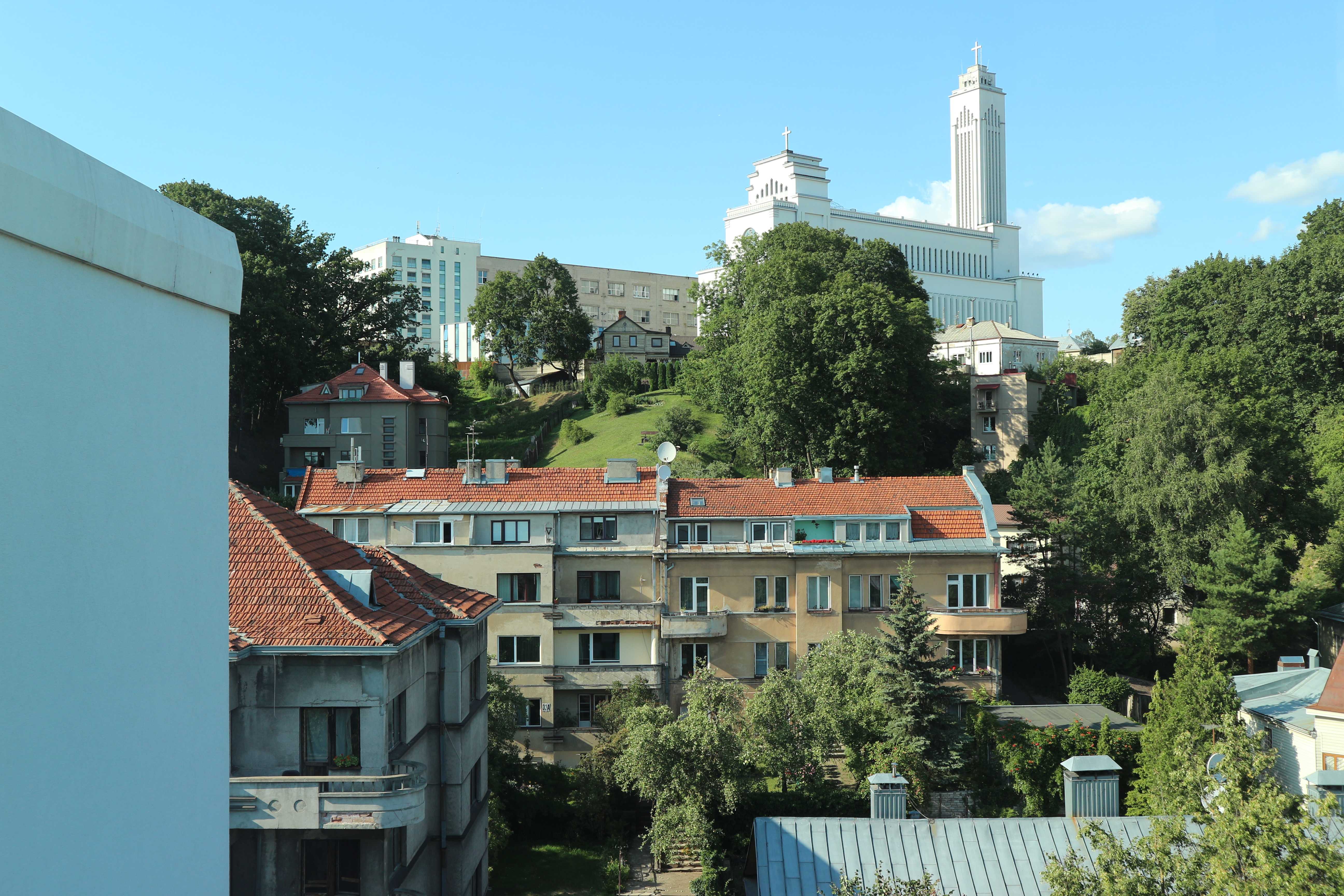
The hillsides of the New Town. Photograph: Ž. Rinkšelis (2019).
The Industrial Area of the New Town
In 1847, an industrial zone had begun to form in the south-eastern part of the New Town. Since the 16th century, a lot of this land belonged to the Carmelite Church of St. Cross and the Discalced Carmelite Monastery residing nearby (1128). The village of Kaunakiemis ended up forming around the Church due to it being located on the crossroads of Kaunas and Vilnius. The village used watermills, there was also an inn. The settlement also had an irregular street plan. In 1859–1862, following the completion of the railroad and train station, large factories had started being built in the southern part of the territory, by the river Nemunas. When the new train station had started operating, in 1862, a new road was built – Vytauto (Michail) prospektas. The road connected the Old Town with the train station. During the Interwar Period all the factories had remained in the area of the former Carmelite Monastery. Rather than being relocated somewhere else, the massive metal factories were repurposed to manufacture textiles and food. The necessary supplies were transported by train or by ship, through the river Nemunas. The development of the Industrial Area of the New Town was particular in that the natural frame (the hillsides of Žaliakalnis, Girstupis valley, banks of the river Nemunas) was considered during the city-planning process. What is more, the division of the territory into the two functional zones – the cluster of representational modernist public spaces by the Vytauto pr., and the zone of modern industrial facilities – has proven to stand the test of time.
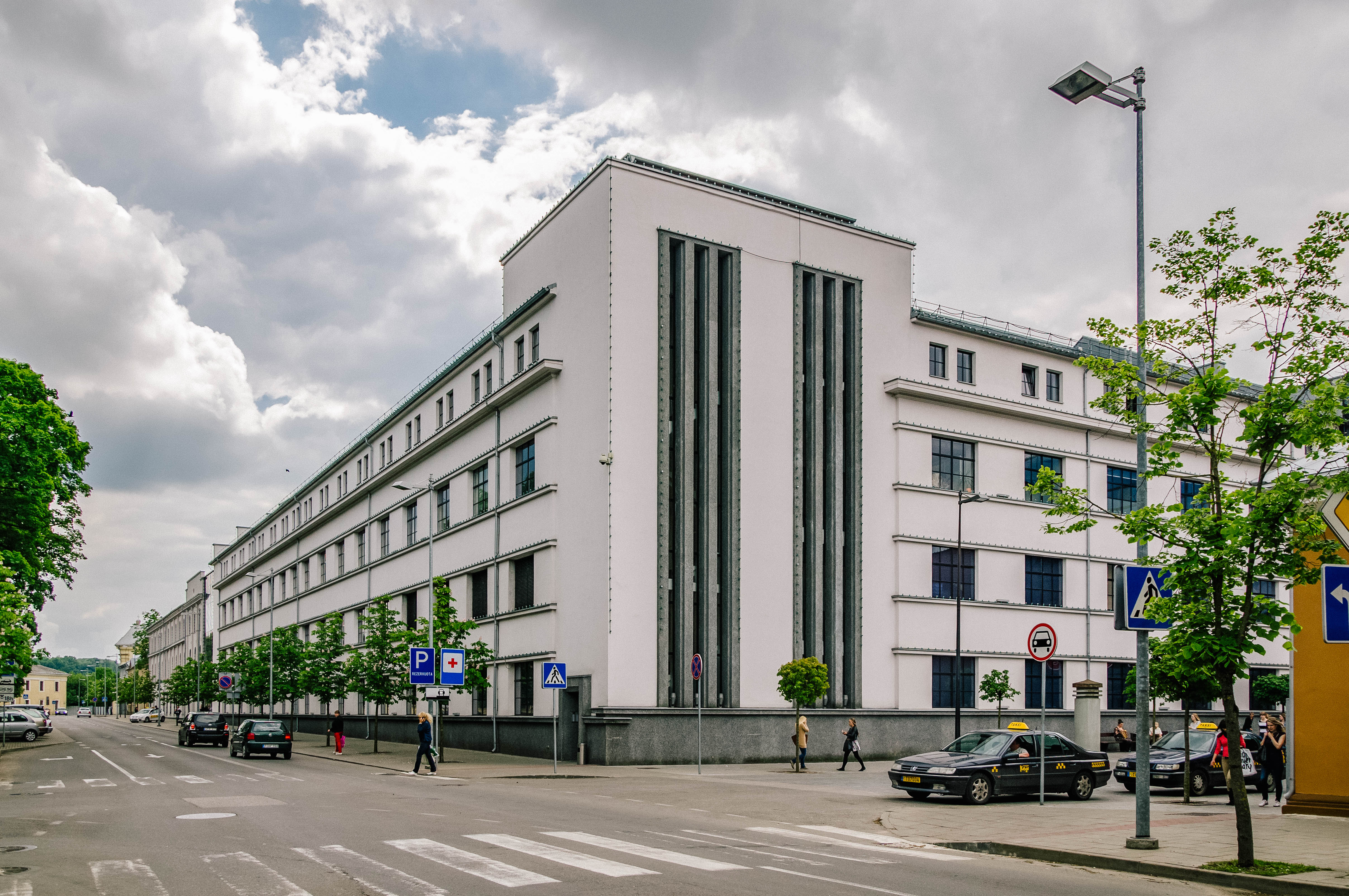 The Industrial Area of the New Town. Photograph: P. Tautvydas Laurinaitis (2013).
Žaliakalnis
Gėlių Ratas – the Garden City
The Historical Area of Kaunas City referred to as Žaliakalnis (unique code 22148), particularly the area of Gėlių Ratas, is enclosed by Vydūno Avenue in the southeastern edge, K. Petrausko St. in the southwestern, and Radvilėnų pl. in the north-western and north-eastern edges. Gėlių Ratas was developed following the principles of a garden city, and had most of the buildings and facilities in the area being built from 1923 to 1939. There was a total of 347 buildings erected, of which 285 were wooden, and 62 – brick buildings. The territory covers 60.91 ha of land. The garden city Gėlių Ratas is unique in its’ uniform planning, geometric structure, successful integration of the heritage of the former military stronghold, sustainable employment of its’ natural frame in a built environment, and local interpretation of modernist architecture reflected by private residential buildings and properties. The area is a remarkable example of modern realisation of the garden city structure; a common feature of the 20th century suburban architecture.
 A private residential building in Vydūno Avenue. Photograph: Ž. Rinkšelis.
The Kaukas District
The northern part of the Historical Area of Kaunas City referred to as Kauno Žaliakalnio 1-oji (unique code: 31280) is known as the Kaukas District. It is surrounded by the Ąžuolynas Park in the south, and enclosed by the private properties located near the Kaukas stairs, as well as Aukštaičių St. in the north-western and western edges. The Kaukas District territory covers 19.67 ha of land. There were 109 residential buildings built in this area from 1920 to 1940. The territory functions as a residential area for middle-class military officers and intelligentsia, and has since retained its’ authentic urban structure and architectural integrity. The Kaukas District is unique in its’ uniform planning, successful integration of the heritage of the former military stronghold, sustainable employment of its’ natural frame in a built environment, and local interpretation of modernist architecture reflected by private residential buildings and properties. The area is a remarkable example of modern realisation of the garden city structure; a common feature of the 20th century suburban architecture.
The Kaukas District. Photograph: Ž. Rinkšelis (2019).
The Perkūnas District
The southern part of the Historical Area of Kaunas City referred to as Kauno Žaliakalnio 1-oji (unique code: 31280) is known as the Perkūnas District. The Perkūnas District territory covers 57.81 ha of land. The territory was developed from 1923 to 1940 into a residential area of prestige villas. The core of the District is situated at the cape of the hill, surrounded by hillsides. Prior to 1940 there were 84 buildings built there, and 169 more since 1940. For this reason, both of these periods are of importance in terms of the formation of the area. The richer residents of the city have found home in the authentic Perkūnas District. Characteristics particular to this District include integrity in regard to buildings typology and stylistics of architecture, and the visual value created by the surrounding hillsides and its panoramas. Thus, the territory is a unique blend of a picturesque natural frame and the modernist architecture of villas.
 The Perkūnas District. Photograph: Ž. Rinkšelis (2020).
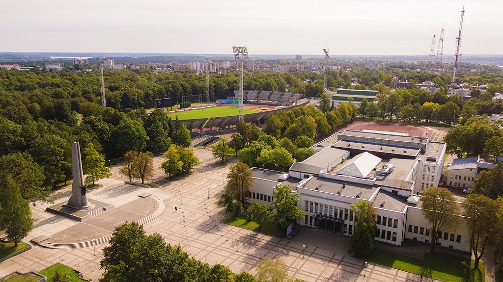
Ąžuolynas Park and the Sports Complex
Ąžuolynas Park is a unique part of the identity of the city. In the whole Europe it is considered the largest oak grove to be maintained within the city territory, with 770 oak trees growing there. The Park covers 84.42 ha of land (unique code 17381). The territory of the Park also includes Parodos Hill, Valley of Adam Mickiewicz, and Valley of Songs. Established during the Interwar Period, the Ąžuolynas Sports Complex and Stadium, the Physical Education Base (currently Lithuanian Sports University) and the Kaunas Sports Hall (Basketball Arena) all reveal the change in lifestyle of a modern society, and are great examples of sports infrastructure with high architectural value.
 Ąžuolynas Sports Complex. Source: Kaunas City Municipality.
Research Laboratory
The former Military Research Laboratory Complex for the Ministry of National Defence is located at the edge of Ąžuolynas and covers 20.9 ha of land (unique code 28567). It is one of the most authentic representations of Kaunas architecture during the Interwar Period. The laboratory is regarded by contemporaries as having been the most modern in the Baltic States not only because of the technical equipment, but also due to its’ stylish modern architecture (Vytautas Landsbergis, Anatolijus Rozenbliumas, Bronius Elsbergas, 1933–1935). In 1940, the Complex consisted of 12 buildings varied in size and functionality. The laboratory itself, as well as 3 other buildings have remained to this day. Two of the three buildings mentioned had formerly functioned as the office with the telephone exchange and apartment for the guard, as well as a factory for woodworking and metalworking. The third building was a glassblower factory: local workers, upon having been trained by a specialist from Czechoslovakia, would manufacture beakers used in chemical experiments at the research laboratory. The laboratory building is distinct in the varied, eye-catching composition of the facade planes; a common characteristic of Bronius Elsbergas’ work. In 1973, the building was recognised as an architectural monument, and in 2015 it became one of the most important buildings to be awarded the European Heritage Label. In 2019, the object has received a grant from the Getty Foundation initiative “Keeping it modern” for the preparation of the Laboratory’s preservation and management plan.
 Research Laboratory. Photograph: L. Mykolaitis (2018).
Frequently Asked Questions:
What is UNESCO World Heritage?
The UNESCO World Heritage List consists of sites that contain “cultural and natural heritage around the world considered to be of outstanding value to humanity”. This List includes unique cultural and natural monuments, such as the Egyptian pyramids, the Great Barrier Reef in Australia, The Galápagos Islands in Ecuador, the Taj Mahal in India, Grand Canyon National Park in the US, and the Acropolis in Greece. These objects have made an impact on the development of world history. The preservation of these heritage sites becomes the responsibility of not only the State, but the international community as well. As of May 31, 2020, the UNESCO World Heritage List includes 1121 objects of cultural and natural value located in 167 States Parties. Among these, four are material heritage sites in Lithuania: Vilnius Historic Centre (1994), Curonian Spit (2000), Kernavė Archaeological Site (2004), and Struvė Geodetic Arc (2005).
How significant is the World Heritage Convention?
The UNESCO World Heritage Convention is an agreement that, in almost 50 years since its’ creation, has become the most important legal instrument in regard to preserving cultural and natural heritage. The 193 States Parties that have ratified the Convention have agreed on it being one of the most successful and effective systems of heritage preservation and international cooperation. This document unites the community under the shared goal of preserving heritage. One of the main aims of the Convention is to encourage responsible solidarity, as well as shared responsibility for preserving the unique, valued properties and cultural experience of humankind.
What importance does the inscription of properties on the World Heritage List have?
The State that has ratified the Convention Concerning the Protection of the World Cultural and Natural Heritage becomes eligible to nominate their heritage sites to be inscribed on the World Heritage List. Upon having the property inscribed on the List, the State Party is provided with the opportunity to actively participate in international cooperation processes regarding cultural heritage, offer and receive expert consultations in the fields of arts, science and technology and, in some exceptional cases, apply for financial support.
The UNESCO World Heritage Label is an individual symbol of international recognition that is accepted worldwide. The sites awarded with the Label are some of the most popular tourist spots in the world, and are used to present the culture of the state. World Heritage Sites are important resources resulting in irrefutable economic returns for the state: they attract tourists, and function as a source of cultural knowledge, all the while leading to increased attractiveness of the state. The presence of such properties is one of the more significant representative resources influencing the image of the state.
Due to international recognition, state residents tend to develop a sense of pride and respect for valued national properties. As a result, there is an increase in civic consciousness and solidarity in terms of preserving heritage important to both the current generation and future ones to come. This way, heritage protection and preservation improve in terms of effectiveness, since people understand the importance of these properties better and feel more responsible for them.
Who owns the site inscribed on the World Heritage List?
The site inscribed is the property of the State in which it is located, and is protected under national law. By ratifying the Convention, the State Party agrees to undertake the identification, protection, preservation and presentation of cultural and natural heritage sites. According to the Convention, in order to ensure that these processes are successful, the State Party shall also cooperate with the international community and choose the most effective methods for protection, preservation and presentation of heritage sites.
What is the process of inscription?
Submission of nomination files and the process of final evaluation are preceded by the long process of nomination that takes no less than two years. Only the State in which the property is located can nominate the property to be included in the List.
In order to begin this process, the State has to prepare a nomination file. The file has to meet the selection criteria, provide plans detailing protection and management instruments, and be exhaustive in justification for inscription on the World Heritage List. Nomination file is to be submitted on behalf of the State Party (signed by the delegated official on behalf of the State Party). The nomination is submitted to the World Heritage Centre for review and to check if it is complete. Upon approval, the file is sent to be evaluated by the Advisory Bodies: the International Union for Conservation of Nature (IUCN), and the International Council on Monuments and Sites (ICOMOS), which respectively provide the World Heritage Committee with evaluations of the cultural and natural sites nominated. The Committee then makes the final decision on the inscription of the property. The property has to be included in the Tentative Lists of States Parties before the nomination process is started.
Does the inclusion of a property among the Tentative Lists of States Parties mean that it is now a UNESCO World Heritage Site?
The inclusion of a property in the State Party’s Tentative List represents the State’s intent to submit the nomination file for the property to be included on the World Heritage List. The Tentative List provides information on the valued national properties of the State. It includes all details necessary for the States Parties, World Heritage Committee, World Heritage Centre, and the Advisory Bodies to be able to assess the properties and make a decision on their inscription. The Tentative List of Lithuania currently includes Kaunas modernist architecture and Trakai Historical National Park.
Can a World Heritage Site be removed from the List?
A World Heritage Site can be removed from the List, but this is done only in extreme cases, when all protection and preservation methods have been exhausted. Since the creation of the List in 1975, only twice has a removal of a property been carried out. In 2007, the Arabian Oryx Sanctuary in Oman was removed, and in 2009 the Dresden Elbe Valley had its’ status of a World Heritage Site revoked as well. The process of pending removal is carried out through long debates among politicians, diplomats, and experts – all involved parties. World Heritage Committee expects active involvement of the local community in terms of protecting World Heritage Sites.
Properties that are on the brink of being destroyed in any way are placed on the List of World Heritage in Danger. This is done in hopes that the global community will notice the danger posing the World Heritage Site, and take immediate measures to protect it.
Despite the fact that placement of a property on the List of World Heritage in Danger has a negative side to it as well, such a decision is to be interpreted as a site protection measure. When a Site is placed on this List, the World Heritage Committee, together with the State, prepare a plan of instruments and methods for avoiding potential destruction of the property. If any improvement is noticed, the property is re-inscribed on the World Heritage List. According to the data published on May 31, 2020, 53 of current World Heritage Sites are under the danger of being destroyed.
Myths and misinformation regarding UNESCO:
“UNESCO will prohibit any activity, limiting us“
Even if the property is inscribed on the World Heritage List, the legal provisions regarding any activity related to the property will not change. Recognition of the site as World Heritage does not lead to any limitations or prohibitions; instead, it results in added value (potential for development) for immoveable property and territories. Due to its’ unique image, a property may witness an increase in tourists and potential funding for related activities (indirect revenue for the city).
“Being recognised by UNESCO will be like finding a pot of gold”
That is not true. UNESCO does not provide funding; rather, this is a unique opportunity to use the famous label in hopes of becoming more recognised on a global scale. The aim of the application is not to receive some financial benefits. Instead, through this process we get a chance to promote Kaunas City and have it create some added value.
“This is such a small city, who will even notice it?”
The city is already becoming more recognised in Europe due to its’ unique architecture. The UNESCO World Heritage Label is the most widely acknowledged worldwide, which means that if Kaunas City becomes a World Heritage Site, entirely new opportunities for international cooperation would be present. The strengthened identity of the city affects us all as well – we all feel much prouder of ourselves when we are valued by others.
Expert Group for the Preparation of the Application 2019–2020:
Experts who contributed to the preparation of the application:
Vaida Almonaityte-Navickienė, Giedrė Jankevičiūtė, Arvydas Pakštalis, Nijolė Steponaitytė, Paulius Tautvydas Laurinaitis, Jūratė Tutlytė, Jonas Vaičenonis, Kęstutis Zaleckis, Andrijana Filinaitė. Rengiant paraišką konsultuotasi su tarptautiniais ekspertais: Jad Tabet, Dennis Rodwell, Mike Turner.